In June and October 2022, the University of Birmingham WM-Air project conducted measurement campaigns to monitor real-world emissions from vehicles travelling along busy roads within the West Midlands. The video below shows the deployment of this measurement system, which is explained further in this article.
Road transportation is the backbone of social and economic development, having a profound impact on both economic growth and employment rates. However, it is one of the leading sources of air pollution in urban environments. Many mitigation strategies such as Clean Air Zones are designed based on a detailed understanding of the emissions from different vehicle types based on manufacturer testing. However, real-world on-road emissions may differ from these – depending on vehicle age, maintenance etc. Understanding the real-world emissions for the West Midlands fleet lets us develop and fine tune clean air measures, and predict the impacts of different policy options.
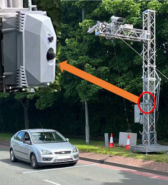
WM-Air used a vehicle emission remote-sensing system (VERSS), which use laser spectroscopy techniques, to provide real-world emission rates for vehicle fleets within a deployment area. VERSSs are installed on the road-side (figure 1), and rapidly measure the emission rate of the passing vehicles [1].
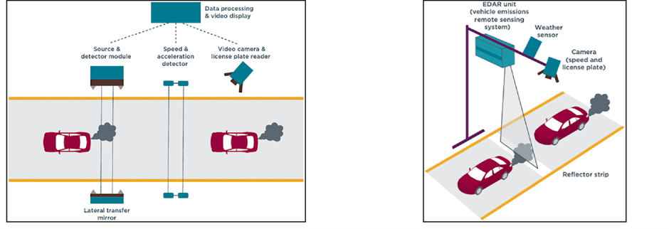
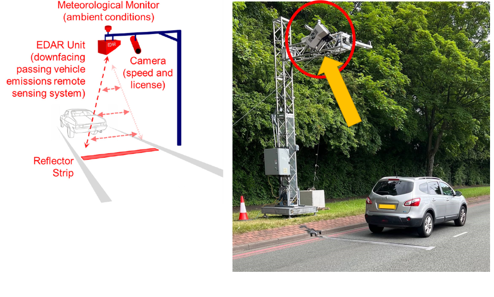
A range of VERSSs have been operated across the UK for almost two decades, providing a detailed, real-world picture of the on-road vehicle emissions. Emissions Detection and Reporting (EDAR) system, developed and commercialised by Hager Environment and Atmospheric Technologies (HEAT; www.heatremotesensing.com [2, 3]), is one of the newest and most advanced VERSSs, and instantaneously measures the emission rates of the passing vehicles (figure 2).
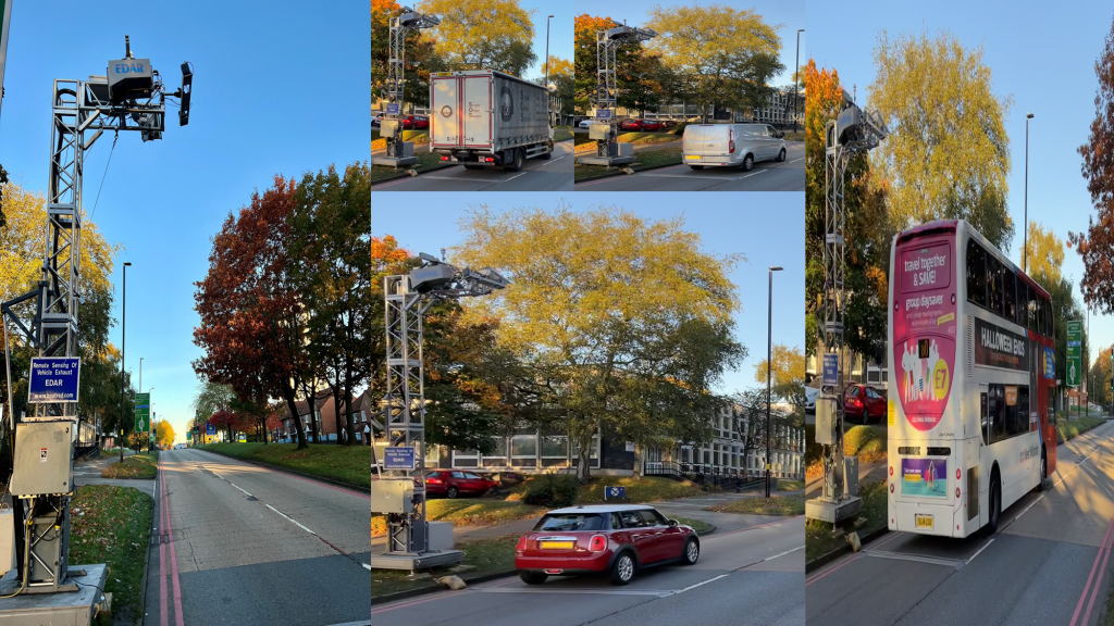
In June 2022, the WM-Air team deployed EDAR on Wolverhampton Road in Sandwell, studying the real-world emission rates of more than 60,000 passing vehicles (figure 3a). In October 2022, EDAR was deployed on the A4540 in Birmingham, measuring emissions from more than 35,000 unique vehicles (figure 3b). The data are anonymised and averaged together – it is not possible to link measurements to individual vehicles.
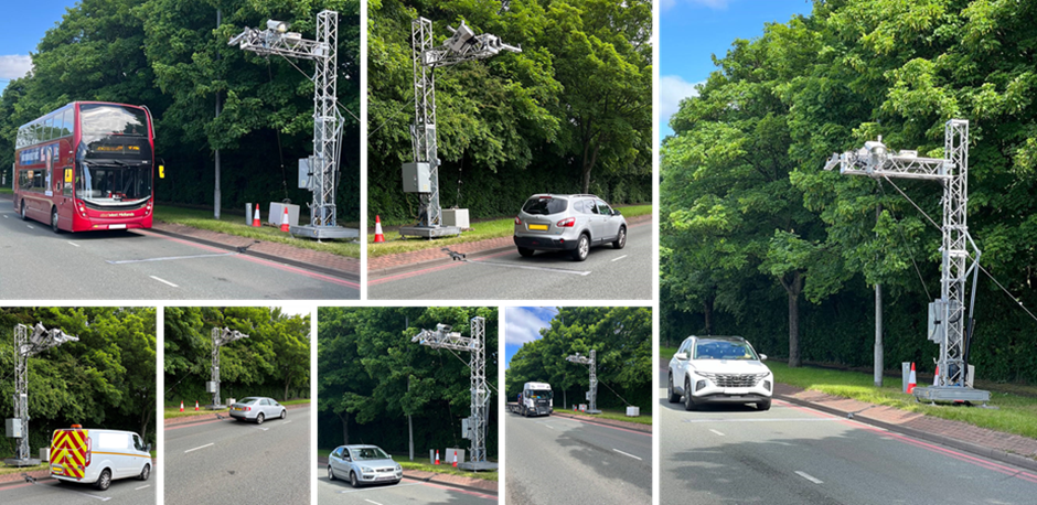
Figure 3a: Some of the vehicles what were observed during the June campaign.
Alongside EDAR, ‘Traffic EAR’ was also installed (figure 4). Traffic EAR was designed and developed by the Innovation Factory (www.innovfactory.com), and uses artificial intelligence (AI) algorithms to detect vehicle type according to its sound. The WM-Air team will be exploring the sound of the West Midland’s traffic fleet in order to develop a traffic noise inventory for the region, and explore its relationship with measured vehicle emissions.
If you have any questions about EDAR, the deployment campaign, or are interested in the results, please contact:
References
[1]. Plogmann, J., A. Gubser, and P.D. Eggenschwiler. Remote Sensing Measurements and Simulations for Real Driving Emission Characterization of Vehicles. in 22. Internationales Stuttgarter Symposium. 2022. Wiesbaden: Springer Fachmedien Wiesbaden.
[2]. Ghaffarpasand, O., et al., Real-world assessment of vehicle air pollutant emissions subset by vehicle type, fuel and EURO class: New findings from the recent UK EDAR field campaigns, and implications for emissions restricted zones. Science of The Total Environment, 2020. 734: p. 139416.
[3]. Ropkins, K., et al., Evaluation of EDAR vehicle emissions remote sensing technology. Science of The Total Environment, 2017. 609: p. 1464-1474.